Gambier Islands
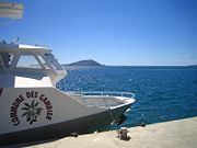
Archipelago in French PolynesiaThe Gambier Islands are an archipelago in French Polynesia, located at the southeast terminus of the Tuamotu archipelago. They cover an area of 27.8 km2 or 10.7 sq mi, and are made up of the Mangareva Islands, a group of high islands remnants of a caldera along with islets on the surrounding fringing reef, and the uninhabited Temoe atoll, which is located 45 km south-east of the Mangareva Islands. The Gambiers are generally considered a separate island group from Tuamotu both because their culture and language (Mangarevan) are much more closely related to those of the Marquesas Islands, and because, while the Tuamotus comprise several chains of coral atolls, the Mangareva Islands are of volcanic origin with central high islands.
Read article


.jpg)
Top Questions
AI generatedMore questions
Nearby Places

Mangareva
Island of the Gambier Islands in French Polynesia
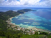
Rikitea
Town on Mangareva, part of the Gambier Islands in French Polynesia
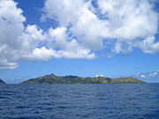
Taravai
Island in French Polynesia
Rumarei
Island of French Polynesia
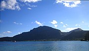
Mount Duff
Mountain in French Polynesia
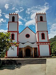
St. Michael's Cathedral, Rikitea
Church in French Polynesia
Gambier (commune)
Commune in French Polynesia, France

Mont Mokoto
Mountain in French Polynesia